But 12 Republicans crossed the aisle and joined Democrats opposing the bill
After failing twice in November to convene Indiana’s state legislators for a redistricting session, Indiana’s House of Representatives, dominated by Republicans, have met twice this week attempting to fulfill President’s Trump request to give his party a larger majority of representatives in the U.S. House
Republicans want to control all 9 of Indiana’s U.S. House seats, where they now hold seven. The remaining 2 seats are held by Democrats.
All 9 congressional seats will be on the ballot in the 2026 primary and general elections.
Republicans are targeting the two districts held by Democrats. By redrawing congressional district boundaries, they hope to change those districts from blue to red.
On Monday, HB 1032, a redistricting bill authored by Rep. Ben Smaltz (R-Auburn) was introduced and assigned to the House Committee on Elections and Apportionment for its first hearing.
On Tuesday, the committee approved the bill and its draft map showing new boundaries for all of Indiana’s 9 Congressional Districts.
Rep. Carolyn Jackson (D-Hammond) offered an amendment in committee to require public hearings to be held across the state since that was not included in the bill, but Republican committee members shot it down.
Although Rep. Earl Harris (D-East Chicago) described it as a map that looked like a kid had colored it using crayons, the proposed map looks more like a jigsaw puzzle.
A lot of work went into counting to put Indiana’s population equally distributed across its 9 congressional districts. Smaltz said the House and Senate GOP worked with the National Republican Redistricting Trust to draw the new boundaries.
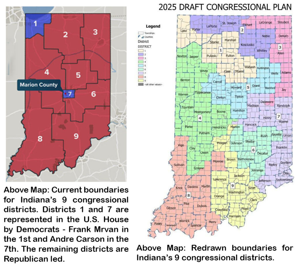
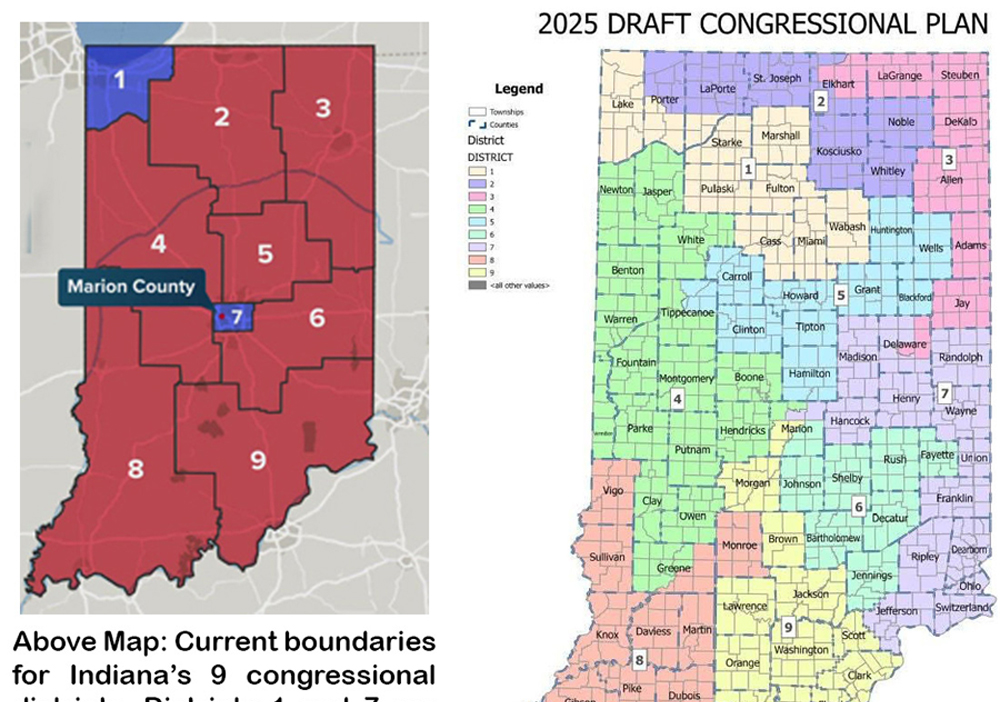
Currently, the First Congressional District, represented by Democrat Frank Mrvan, includes all of Lake and Porter counties, and 6 townships in the northwest corner of LaPorte County.
The redrawn border of Republican-held Congressional District 2 pushes west, taking in the 6 townships in LaPorte County’s northwest corner and the townships in the northern half of Porter County.
The redrawn boundary for District 1 includes all of Lake County, the townships in the southern half of Porter County, and 4 townships in southern LaPorte County.
District 1 expands further, taking in 7 counties south of LaPorte and St. Joseph counties. Cass County, Fulton County, Marshall County, Miami County, Pulaski County, Starke County, and Wabash County are Republican strongholds.
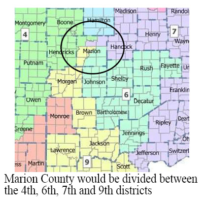
Under the current Indiana congressional map, most of Marion County is in District 7. The district is represented by Andre Carson, a Democrat. Under the proposed map, the county would be divided between the 4th, 6th, 7th and 9th districts.
Indianapolis, the state’s largest city and the state capitol is in Marion County.
A second reading of the bill was held Thursday before the full House where members could propose amendments to HB 1032. All amendments offered by Democratic members were voted down.
The third and final House reading was held today, Friday, resulting in passage of HB 1032 by a vote of 57-41; 12 Republicans crossed the aisle and joined Democrats opposing the bill.
The bill next goes to the Indiana Senate for passage, repeating the hearings held by the House. The senate will take up the bill on Monday, December 8. A final vote is expected on December 12.